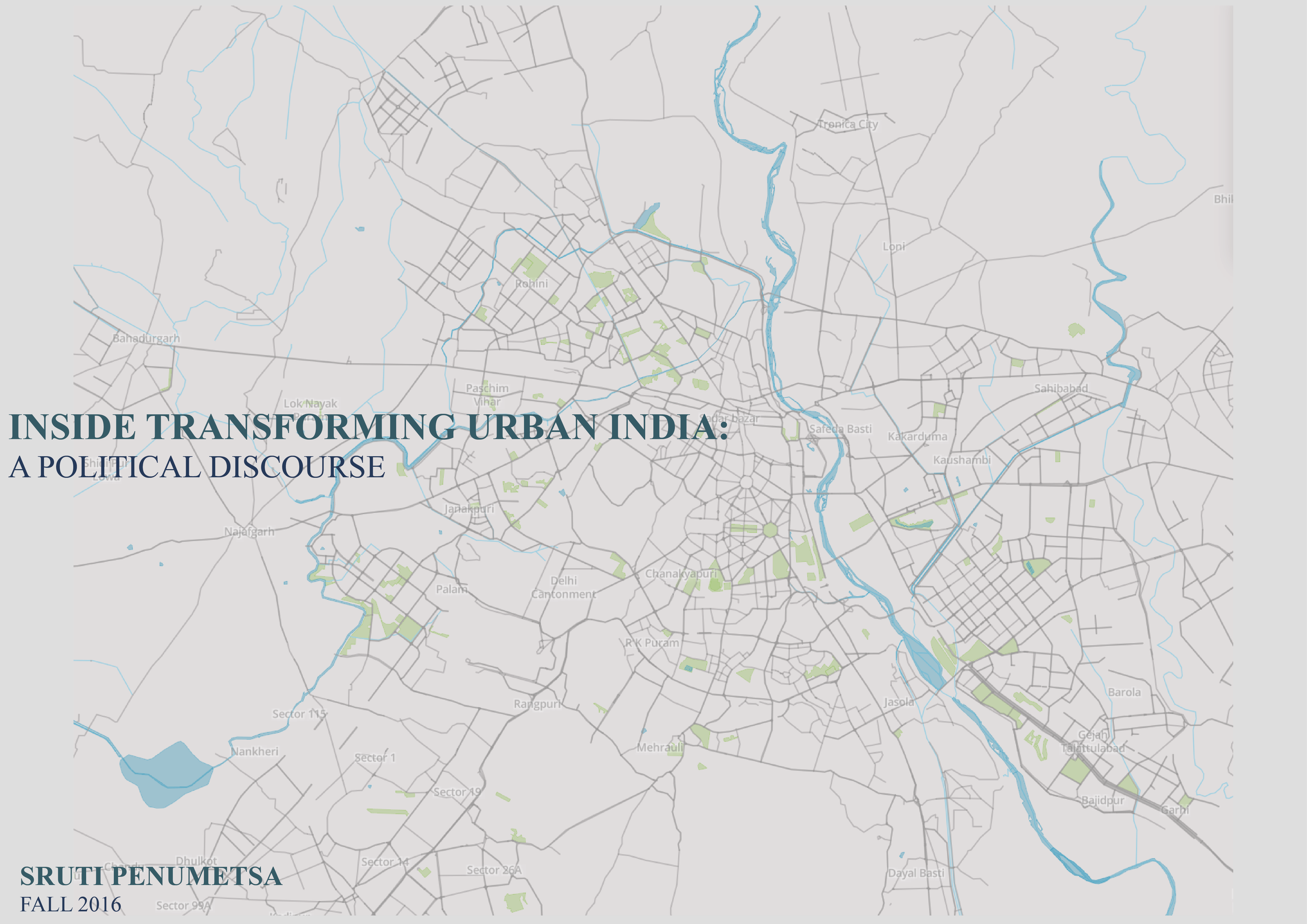
INSIDE TRANSFORMING URBAN INDIA
Delhi, India
By Sruti Penumetsa
globalization, unplanned settlements, social exclusions, political discourse
My project is a visualization of the political discourse of social exclusion in Delhi, the capital city of India.
INSIDE TRANSFORMING URBAN INDIA
There is arguably no city in India better equipped to manage a growing population. Delhi is the richest city and state in the Union, and as the capital city, has long enjoyed a disproportionate share of Central funds . Located in the middle of a flat agrarian region with no natural barriers to expansion, Delhi has accommodated population growth through sprawl and is the least densely populated city of India. The city has largely spared the nativist politics and communal tensions that are common to most Indian cities.Yet despite these advantages, Delhi is a deeply divided city marked by extreme forms of social exclusion. My project is a visualization of the political discourse of social exclusion in Delhi, the capital city of India. This map is a visualization of all the cities in India categorized by the population. The two mega globalizing cities in India are Delhi and Mumbai with population over 10 million.

The modern city of Delhi, systematically excludes most of Delhi’s residents. Over the decades it has systematically excluded the majority of Delhi’s citizens from inclusion in the planned city. It has done so through its actions giving clear preferential treatment to the higher income groups and all but shunning the lower classes but also through its own stated objectives. In recent decades, it has become far more committed to valorising returns on land than planning for an inclusive city. The urban landscape of Delhi is governed by its complex political discourse. Delhi being the capital city, a state and a union territory within itself, its governance lies in a very complex intersection of local, state and central governance.
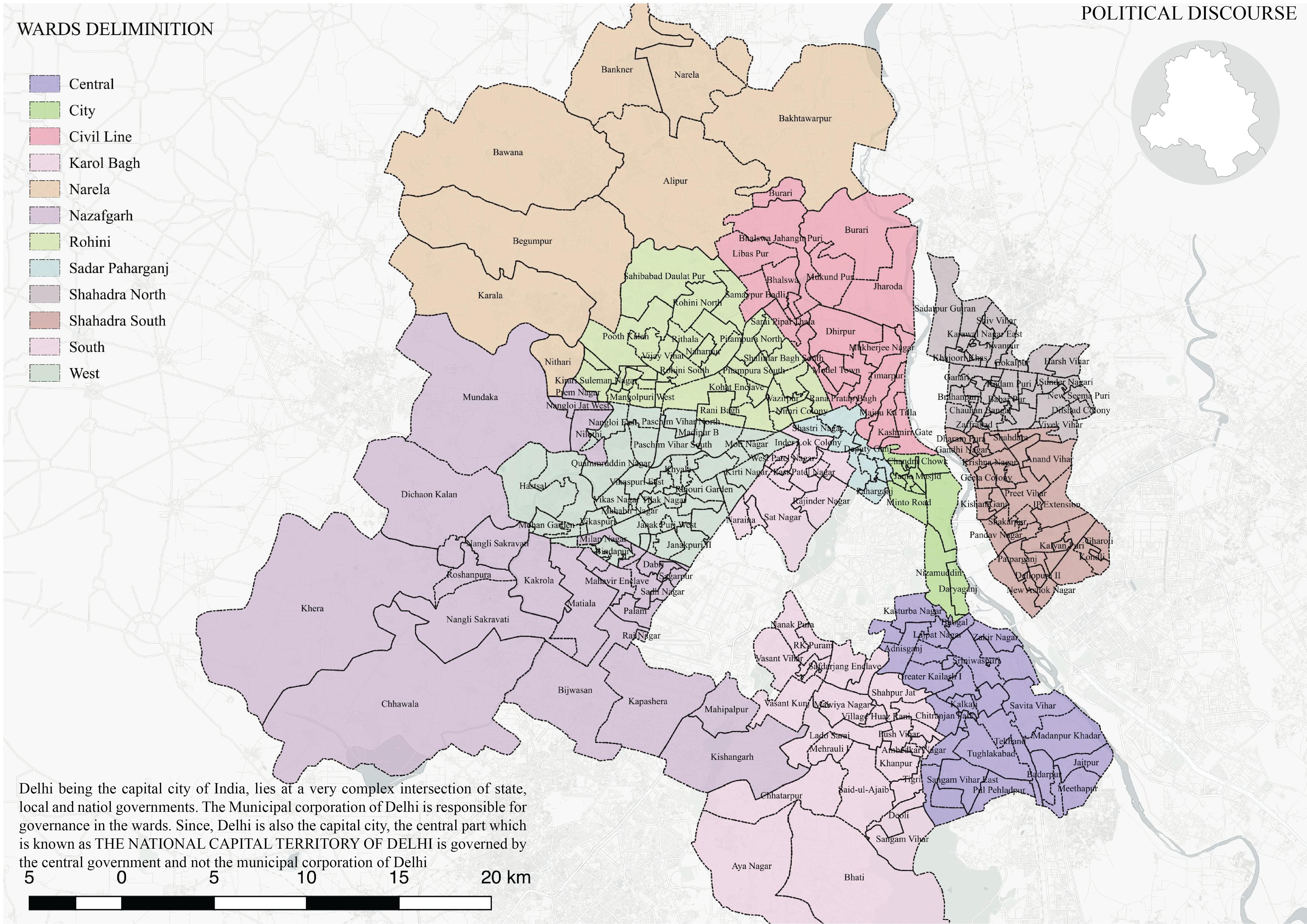
The following maps visualize the complexity in the political delimitation of the city. The first map is the ward divisions which lie within each district and sub further within sub district. The central part which is not divided is designated as the NCT of Delhi and the ward divisions does not come under the Municipal corporation of Delhi. The NCT governance is regulated at a state level and hence has a separate form of regulation, even though it lies within the city. Hence, the information such a s census and other government data on ward divisions is not available with the Delhi government.
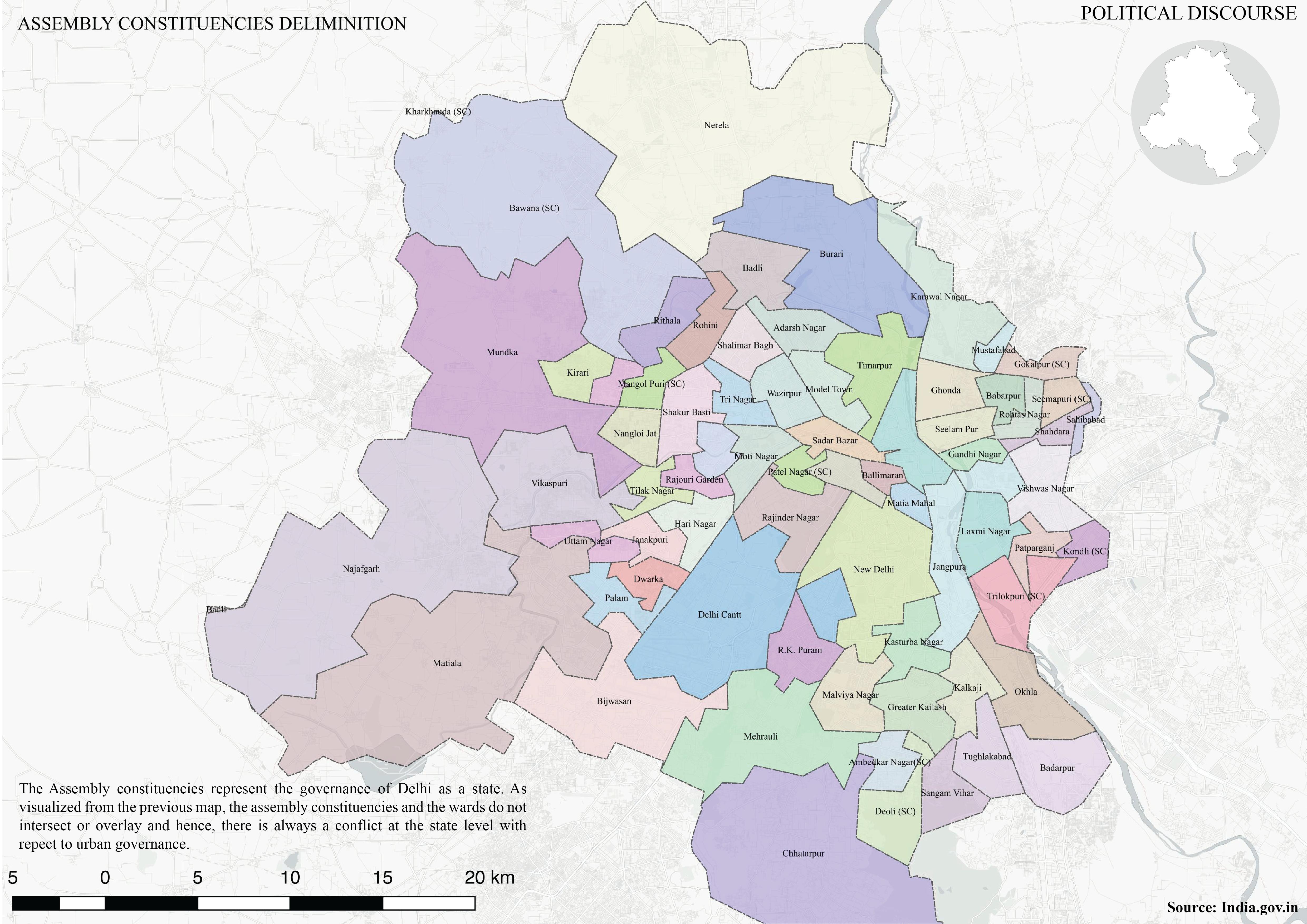
The second map is a map of the assembly constituencies, which defines the governance of Delhi as a state. The assembly constituency becomes the representative government of the people.
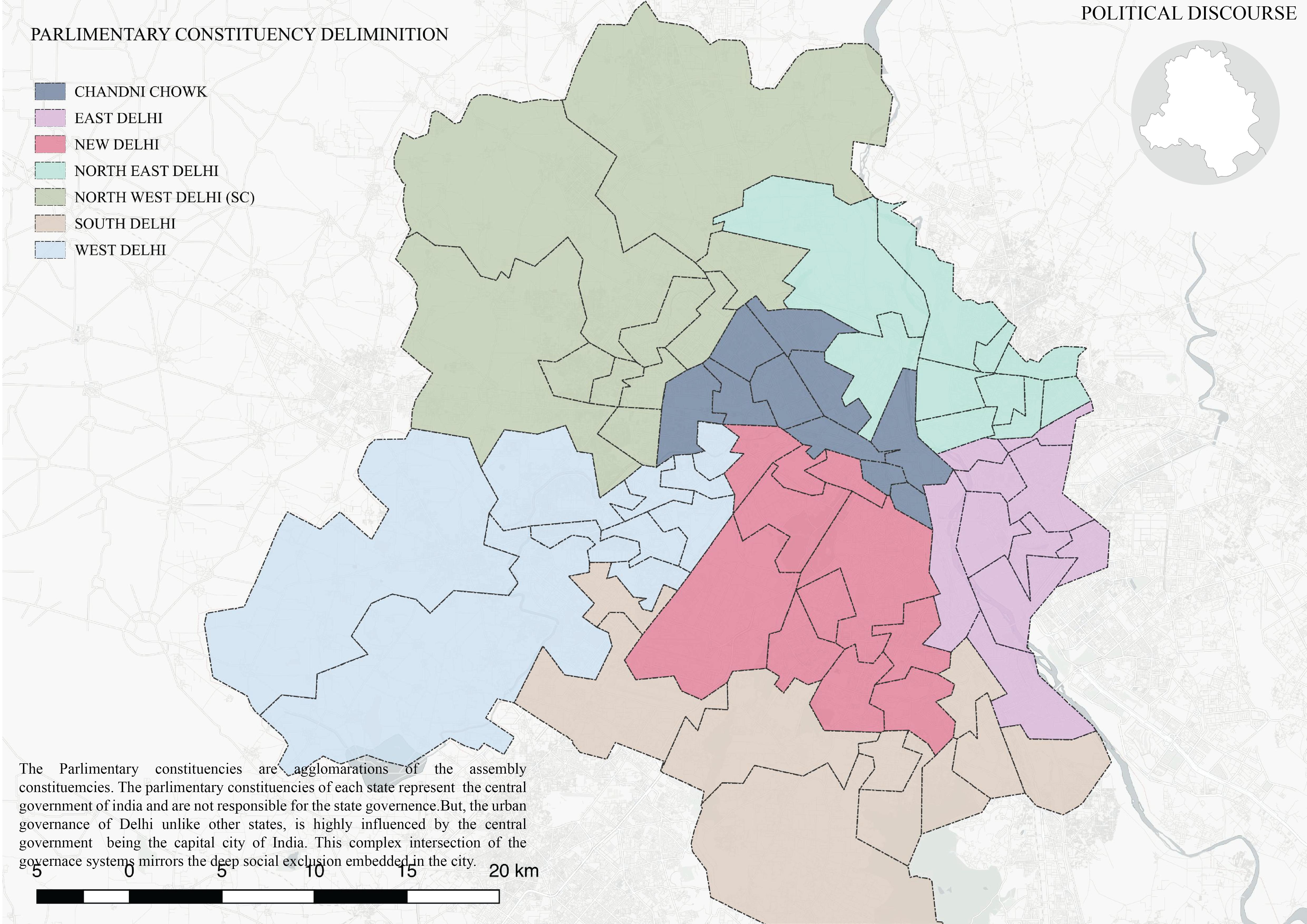
The parliamentary constituencies represent the country’s electoral body of ministers. But Delhi being a capital city is highly influenced by the parliamentary representatives which is the central government. So, this speaks to the complexity of Delhi’s political discourse.The people within the city are often confused with respect to their representative and the governing body. This complexity directly speaks to the deep social exclusions manifested within the city.
The city has a categorization of 7 unplanned settlements which forms 76% of the total population of Delhi. The most vulnerable are the JJC’s (also known as squatter settlements), who get displaced periodically due to development incentives and are put into resettlement colonies regulated by the government. The third is the unauthorized colonies. These three categories of unplanned settlements do not receive any basic services from the government. I created this map on CARTO which locates all the three different kind of settlement location, the dataset for which I created myself. I then spatially joined these settlements with their respective wards, assembly and parliamentary constituencies.This information is displayed in the information box, when clicked on each of the settlement location. This was an attempt to make the political discourse transparent and to empower NGOs and other civil society organizations with the information of this political discourse, in order to hold the representatives responsible for their “respective political divisions” and advocate for the rights of the dwellers residing within these settlements.
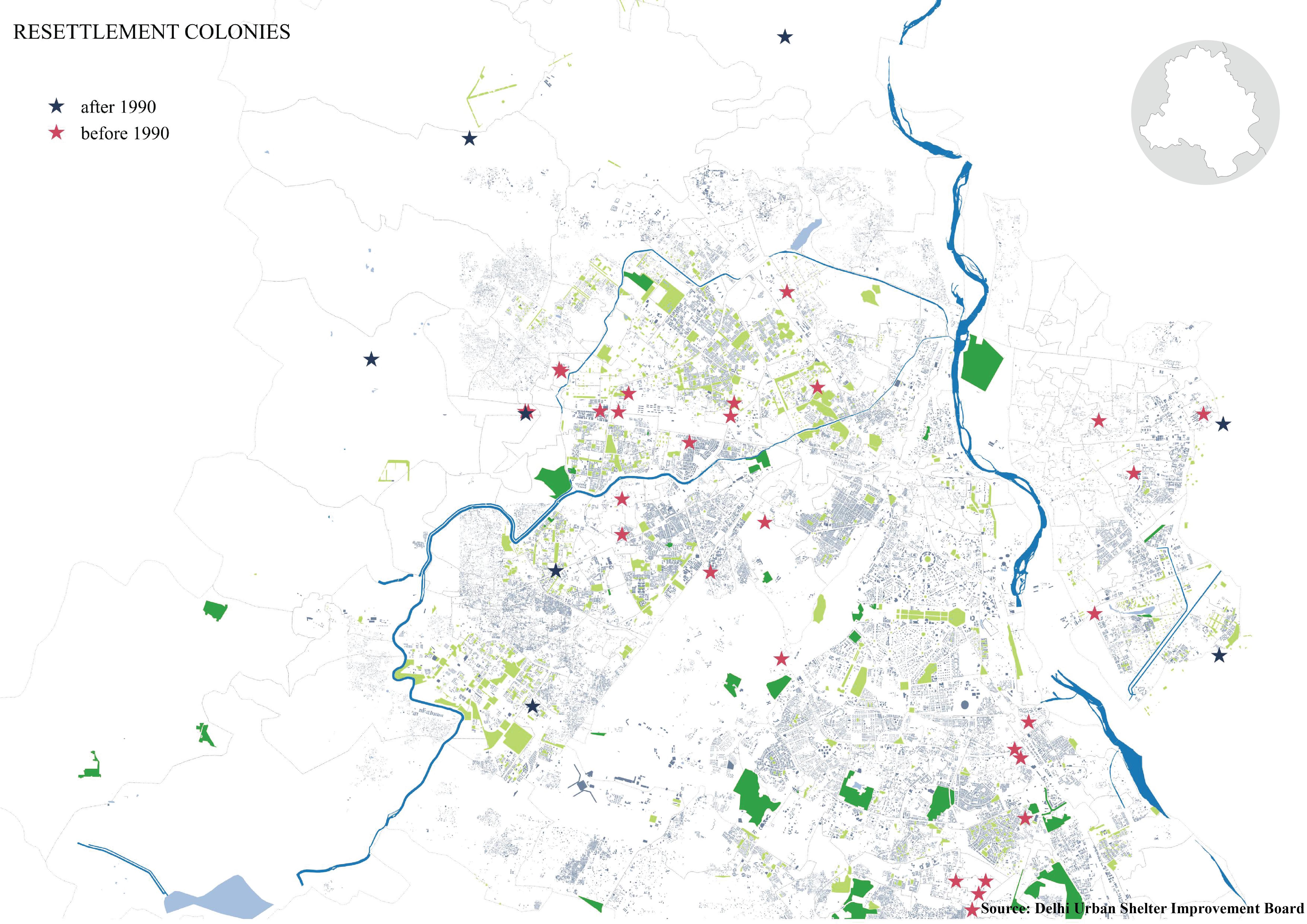
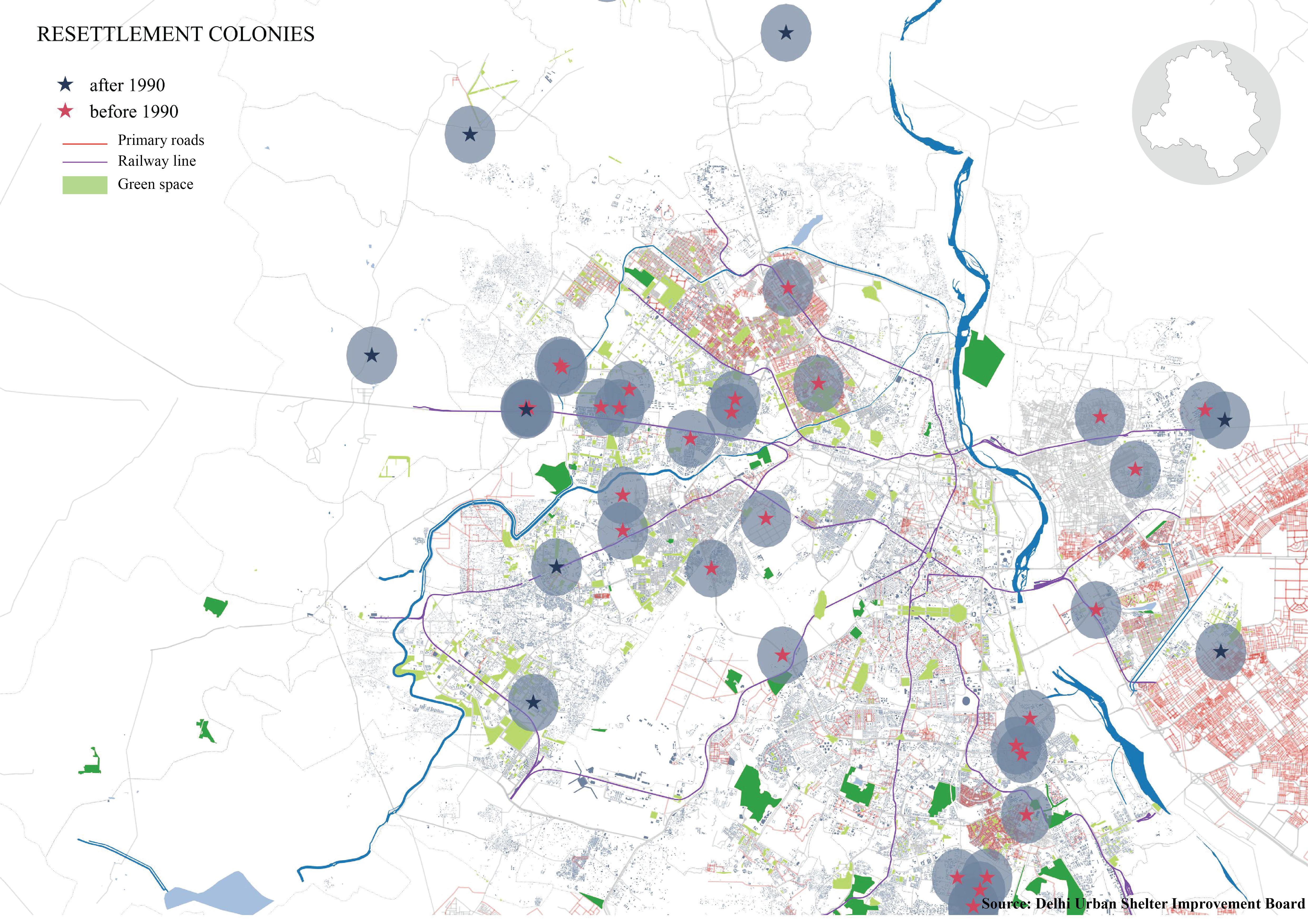
Demolitions and Evictions of these unplanned settlements are common to how the city has developed over the years. After successive supreme court hearings in 2000s, various NGOs and Civil Society Organizations fought against the court orders and advocated for resettlement to those whose who are evicted. In order to make the process of eviction easier, the city resorts to resettlement as a blanket solution. However Resettlement as a blanket solution has been a huge failure in Delhi. Only 30% of the evicted are resettled and moreover, over the years colonies have been pushed to the peripheries of the city, with no connection to public transport and infrastructure systems. The following maps locate the resettlement colonies according to the years they were established and buffered to show their proximity to basic infrastructure systems.
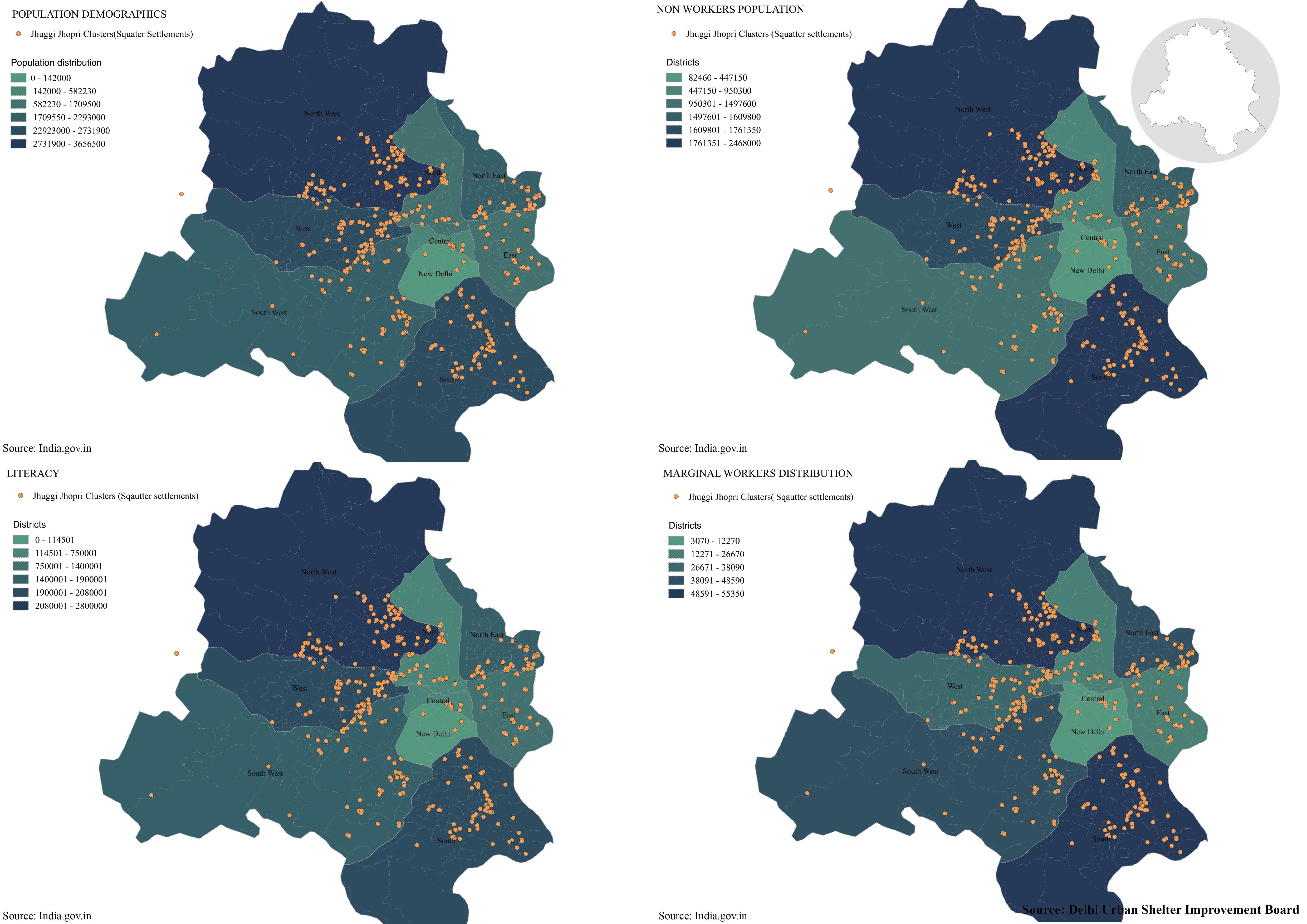
Municipal corporation of Delhi divides the city into Districts and subdistricts but I found census data only with respect to districts and not sub districts. I found according to wards as well, but none of the wards really matched. So, I entered the data for each of the districts and categorized to produce the following section of maps. These maps visualize population demographics, non-workers population, Literacy and marginal workers distribution with respect to the squatter settlements (Jhuggi Jhopri Clusters). These maps were an attempt to visualize the demographics of the JJCs. However, owing to large area sizes of each of the district, the disparity in terms of distribution is almost negligible.
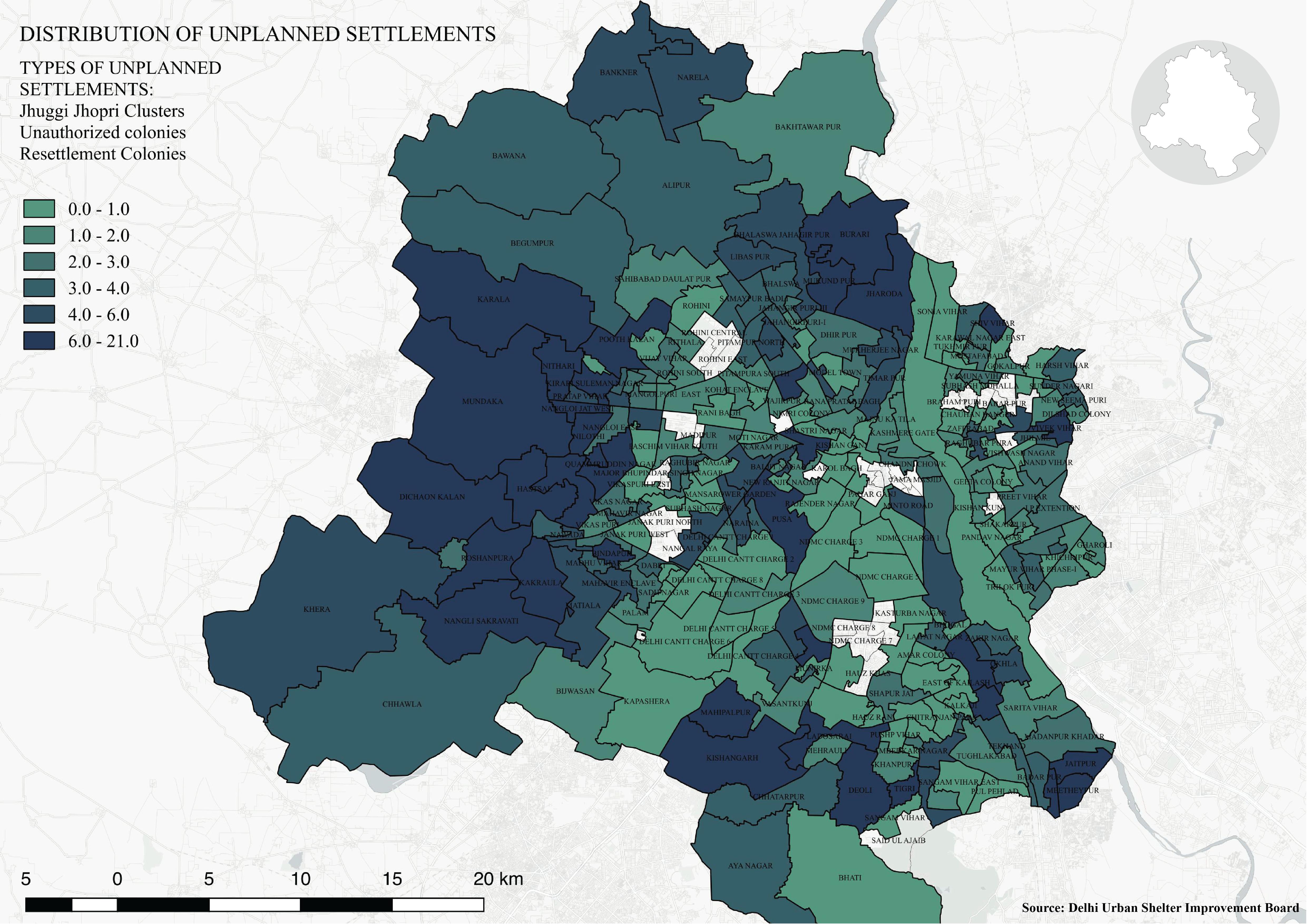
The following map is an aggregate of the three types of unplanned settlements I located on CARTO. I merged these file, to create a choropleth of distribution of these three unplanned settlements to visualize their distribution over the entire city, with respect to wards delimitation.
- Link 1 - thenewschool.carto.com/u/sruti/builder/467a89a4-b8ac-11e6-b080-0e8c56e2ffdb/embed