The Body in Public - Heterotopic Networks of Care
New York, NY, USA
By Gemma Duffee
heterotopia, homelessness, care, the body, comfort stations, automatic public toilets

This is a conceptual exploration of private/public space, homelessness, and sites of everyday care formed by infrastructures and institutions.
My final maps are an exploration of the division of public/private as it relates to planned space, as well as the body in New York City. For my thesis, much of my research is focused on homelessness and the ways in which the public/private binary breaks down as one navigates the city through networks of heterotopias. Public infrastructures such as subways serve as shelter in the winter, while McDonald’s, a private institution, offers food and access to restrooms. There are some institutions that the city recognizes as “public”- libraries and schools- but one must question just how “public” these spaces are or rather, which “public” they cater to. There are areas deemed “residential” but what ways of dwelling do they fail to recognize? How does data and mapping as a planning practice work to reinforce some of these rigid binaries? How can it be used to tell a different story about space and the city?
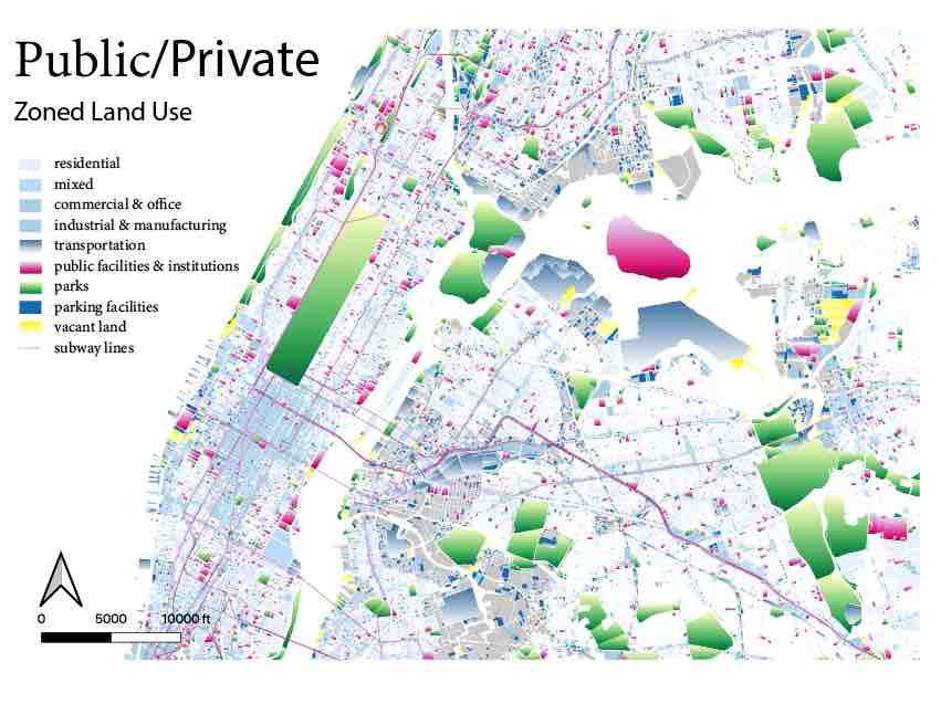
The first map is a land use map built on PLUTO land use data. Rather than making an argument, this map aims to be contemplative and provide space to question the ways that we designate certain functions to space- attributing their use through both planning doctrine and design.
This next map uses theory of heterotopia to challenge the ways in which the lived experiences of space subsume the functions that may be sanctioned or planned by the city. A person in the city, homeless or not, might rest in a public plaza, have a meal or use the toilet in McDonald’s, or access internet and job listings at the library through its infrastructures of social and technical assistance. Through my research, I aim to argue that these spaces provide networks of care that are serving a real (rather than imagined) public. In mapping them and using gradients to highlight their heterotopic qualities, I aim to highlight their importance and bring their informal or “de-facto” functions to the fore. Data from Department of Health inspections, public infrastructure shapefiles, and groundtruthing of PLUTO data with satellite imagery were used to create this map.
As I focused much of my work on homelessness, I began to research the types of infrastructures that the city provides formally, and quickly realized that there is very little data available. While the lack of spatial data in regards to shelters and populations is in one way sensitive and ethical, I believe it is also a reflection of the lack of attention or value given to this area of research.
I made this video after one of my mentors made a comment that homeless people are sleeping in the same places they always have, and that new development is just making it more visible. I used New Building permit applications from the Building Department as data for new development, and 311 calls on homeless encampments and homeless person assistance to spatialize these trends..Each frame of the video represents one month of data between 2010 and 2018.
- Link 1 - thenewschool.carto.com/u/duffg290/builder/601c4d19-be2a-4690-b342-723c34645424/embed